

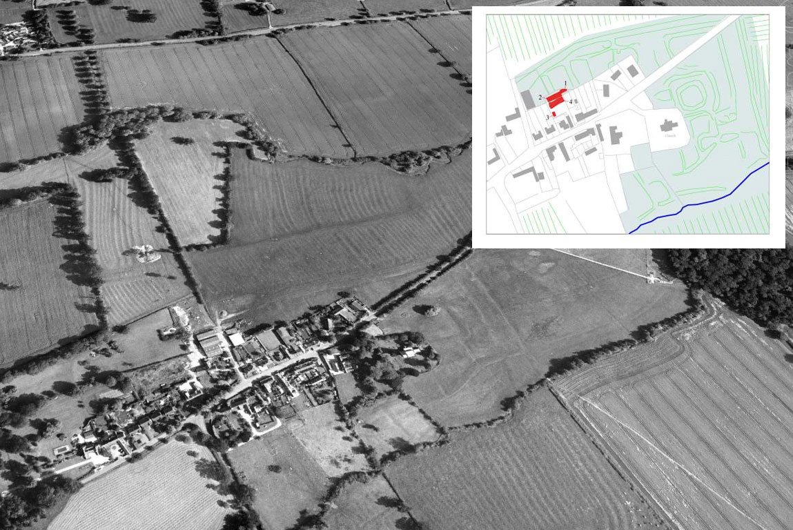
Situated halfway between Market Harborough and Husbands Bosworth, on the Northamptonshire side of the River Welland, is the sleepy little village of Marston Trussell. Part of the site lies within the medieval shrunken village and fieldwork was carried out under Scheduled Monument Consent from English Heritage.
The village is first mentioned in the Domesday Book (AD 1086) as Mersitone, meaning marsh settlement; the Trussell family presumably adding their name to the village after they became lords of the manor in the 13th century. Today, the village is much reduced but its original extent. This is clearly visible in aerial photographs, with extensive earthworks to the east around the church and to the north of the present village framing its ‘shrunken’ size.
Although the first documented evidence of the village dates to the 11th century, a small quantity of early/middle Saxon pottery (c. AD 450 to 850) from the excavations suggests that the origins of the village date back to well before Domesday. Middle/late Saxon pottery and a late Saxon polished stone spindle made from very finely ground sandstone, dating to the 9th – 10th century, highlight continued occupation and provide evidence for traditional home crafts such as spinning and weaving. A small number of isolated features, such as post-holes, pits and gullies, identified during the excavations could also be contemporary in date.
The bulk of the identified archaeology, however, dates between AD 1100-1500 and suggests that this area was predominately used for rubbish pits and quarrying, probably on the outskirts of the settlement. Earthworks in the north-western part of the Scheduled Monument, around the site, take the form of a series of enclosures south of a hollow way. There is no obvious evidence for buildings but these enclosures appear to represent individual holdings typical of ‘croft and toft’ settlement. The excavations found gullies, post-holes and pits within the enclosure earthworks and on a similar alignment which could be associated with early settlement although the main occupation areas are likely to be further north, closer to the hollow way. Many of the larger excavated features, however, are probably quarry pits. These would have been dug to obtain building material and were also often used afterwards as water holes. At least one pit on site contained waterlogged clay and could have been used to store water.
Evidence of medieval village life
Substantial evidence was found for a range of activities associated with life in the medieval village. Cattle, sheep/goat, horse, pig and chicken bones (including butchered, burnt and gnawed bones) represents common domestic waste, which would have been disposed of in pits in the back yards of the dwellings and there is evidence for butchery activities including disarticulation of the skeleton, portioning of joints, defleshing and skinning. The environmental evidence includes cleaned grain with beans/peas probably accidently burnt during food preparation e.g. bread baking, cooking and roasting. Chaff and wild seeds would have been picked out by hand, thrown onto the fire and swept into pits while straw fragments represent the tinder used for the fire. Some grain had been parched in an oven, a process used to harden the grain prior to grinding and make it less susceptible to disease and insect attack during storage. The presence of germinated oats probably represents waste from malting kilns. Rivet wheat was also found. This is a medieval cereal with long straw useful for thatch and is a productive cereal, resistant to fungal and bird attack due to the long awns. It is less favoured for bread making but might have been mixed with bread wheat to make flour.
The Sun Inn
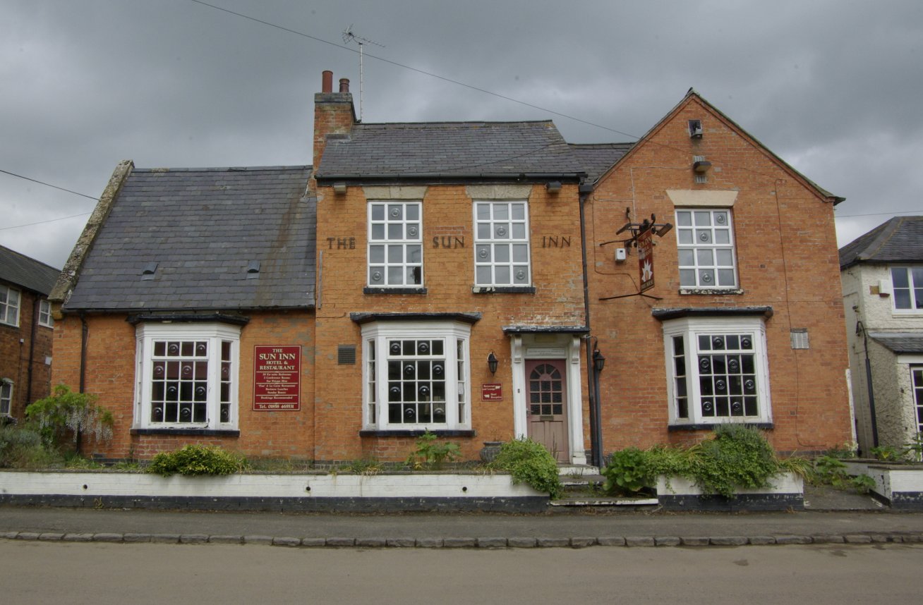
The building of the Sun Inn appears to date from c.1700. In the early part of the 19th century, the eastern part was demolished and replaced with a larger structure, two stories in height, which extended back towards the north to form an L-shaped building. In 1849, the pub was called The Swan and early trade directories record the change of name to the Sun Inn by 1861. Towards the end of the 20th century, the Inn was subject to substantial internal remodelling involving the removal of internal walls and the erection of a large extension to the rear.
