

Damian Goodburn; MOLA (Museum of London Archaeology)
This year’s Festival of Archaeology theme is Climate and the Environment. Archaeological woodwork specialist Damian Goodburn shares what decades of excavation has taught us about sea level change over the centuries, and what bearing this has on life on the Thames floodplain today.
Thanks to extensive archaeology and thorough excavation over the last fifty years, Greater London’s waterfront is probably the best dated and documented archaeological resource for looking at regional sea level change in the world, particularly for the last 2000 years.
By linking closely dated historic timber waterfront structures with adjacent ‘dry land’ features such as building floors, fireplaces and roads, we have been able to show massive changes in relative sea level of the southern North Sea over the last 2000 years, of up to five meters in high tide levels.
For example, our excavations at Pudding Lane – widely known as where the Great Fire of London started in 1666 – unearthed evidence of the city’s Roman waterfront in the form of a large civic timber quay dating to just before AD 100, with substantial warehouses just behind it into which cargoes might have been unloaded from docking ships. The evidence from Pudding Lane, and several other early Roman waterfront sites in London, indicates that around AD100, high tide was around three metres lower than it is today.
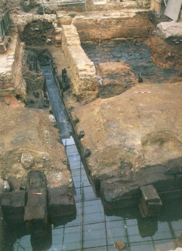
Remains of a wharf frontage found at Bull Wharf in the City of London, tree ring dated to 1123 AD, suggest that after a fall in sea levels during the later Roman period, levels rose rapidly back to similar levels by around 1100 AD.
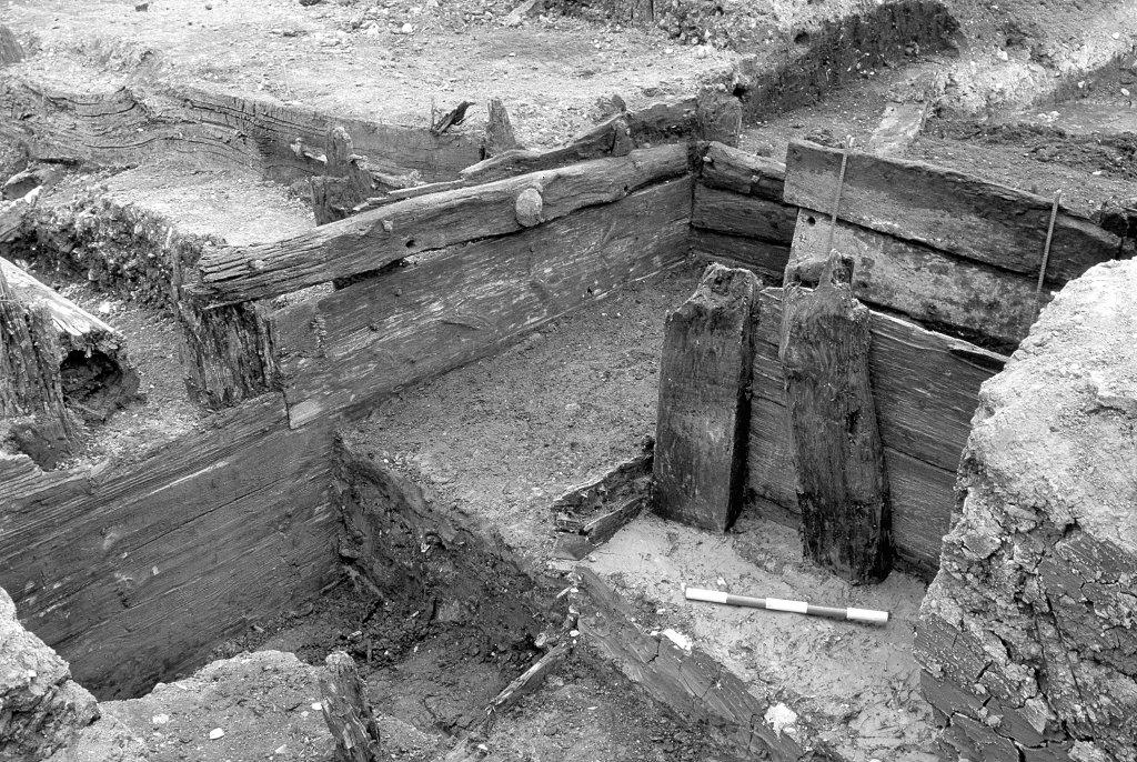
Further along the river at Rotherhithe, excavations uncovered timber waterfronts of post medieval ship building and breaking yards, tree ring dated to the mid 1660s. These waterfronts lay on the riverward side of a working yard surface set at about two metres below today’s levels (one metre higher than the AD 100 levels). Interestingly, the surface of the yard had a thin layer of flood silt over it, which may well have been left by the flood events described by the famous diarist Samuel Pepys, who lived by the river and recorded the tidal floods in the mid 1660s.
The patterns of evidence show that sometimes the changes in sea level were rapid (in geological terms), at around half a metre per century for some periods, and that high tide levels have risen by an average of around 0.6m per century since the 1660s. It is important to bear in mind that changes in the relative levels of the land and sea for the region are also effected by complex factors such as dredging in the estuary and geological land movements. Whatever the various contributing causes, though, the evidence from London’s waterfront archaeology shows dramatic changes in relatively short time periods.
This has a bearing for all those that live and work on the Thames flood plain. The implications of large changes in sea levels, particularly rises, are widespread: from drowning coastal areas, towns on estuaries (like London) and low-lying islands, to controlling the siting of new homes and businesses and the massive costs of major civil engineering for harbour and sea defence works. With the Environment Agency anticipating that the by 2070, the Thames Flood Barrier will need replacing to combat rising sea levels, sea level change is set to become a key, expensive issue in coming centuries.
Many of our publications have shed light on this area, from the work led by Gustav Milne in the 1970s and early 80s, to the work of Trevor Brigham in the late 80s and 90s, and me from the 90s to the present day. If you’re interested in finding out more, the following books are a good place to start:
Milne, G. (1985). The port of Roman London. London: Batsford.
Heard, K., Goodburn, D. M., & Museum of London. (2003). Investigating the maritime history of Rotherhithe: Excavations at Pacific Wharf, 165 Rotherhithe Street, Southwark. London: Museum of London Archaeology Service.
Source: MOLA (Museum of London Archaeology)