
")
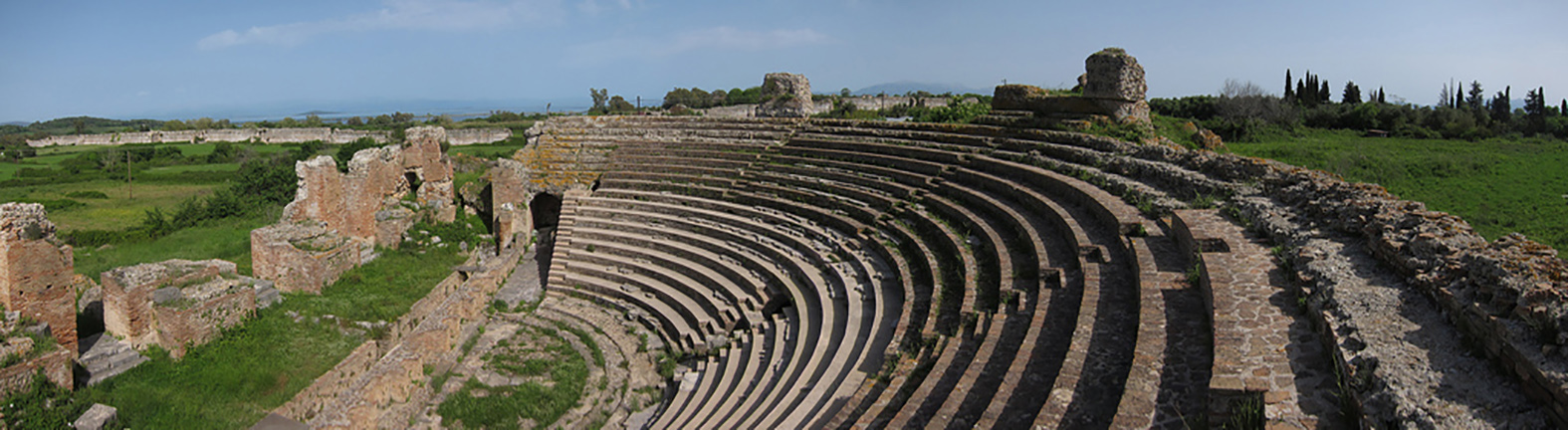
2016 has seen many archaeological discoveries reveal the mysteries behind cultures passed. Just recently a 7,000 year old city was discovered in Egypt, in the southern Sohag province, and earlier in the year archaeologists found hidden rooms in Tutankhamun’s tomb. With much to be learnt from these findings, it’s vital that the information is recorded and preserved for future generations. Here, Michael Dutch, GeoSLAM technical engineer, explains how 3D mobile mapping technology could hold the key to preserving the future of the past, in both a timely and cost effective manner.
In years gone by, archaeological findings were recorded with as much precision as possible in detailed drawings. These drawings would be time consuming, both to initially record and then put onto paper. Allowing others to access the information by creating copies would also see the quality diminish each time.
Of course, technology has made great advances since those days but many challenges remain. Ongoing observation of an archaeological site over several years requires a high level of accuracy so that comparisons can be made in the future. Ancient archaeological sites, often featuring cramped underground chambers, fragile structures and partial ruins, can be challenging and dangerous spaces to work in, so it’s vital that as much information is collated as quickly as possible. This, of course, usually leads to a reduction in the amount of quality data that can be collected and so compromises must normally be made.
Any loss of information when it comes to archaeological research is unfortunate since it can prevent further insight. What is arguably even worse though, is that traditional survey methods of recording data can cause damage to a historical site. Tripods are bulky, time consuming to set up and require physical contact with the ground, as well as obligating the person responsible for collecting the data to put themselves in potentially hazardous situations.
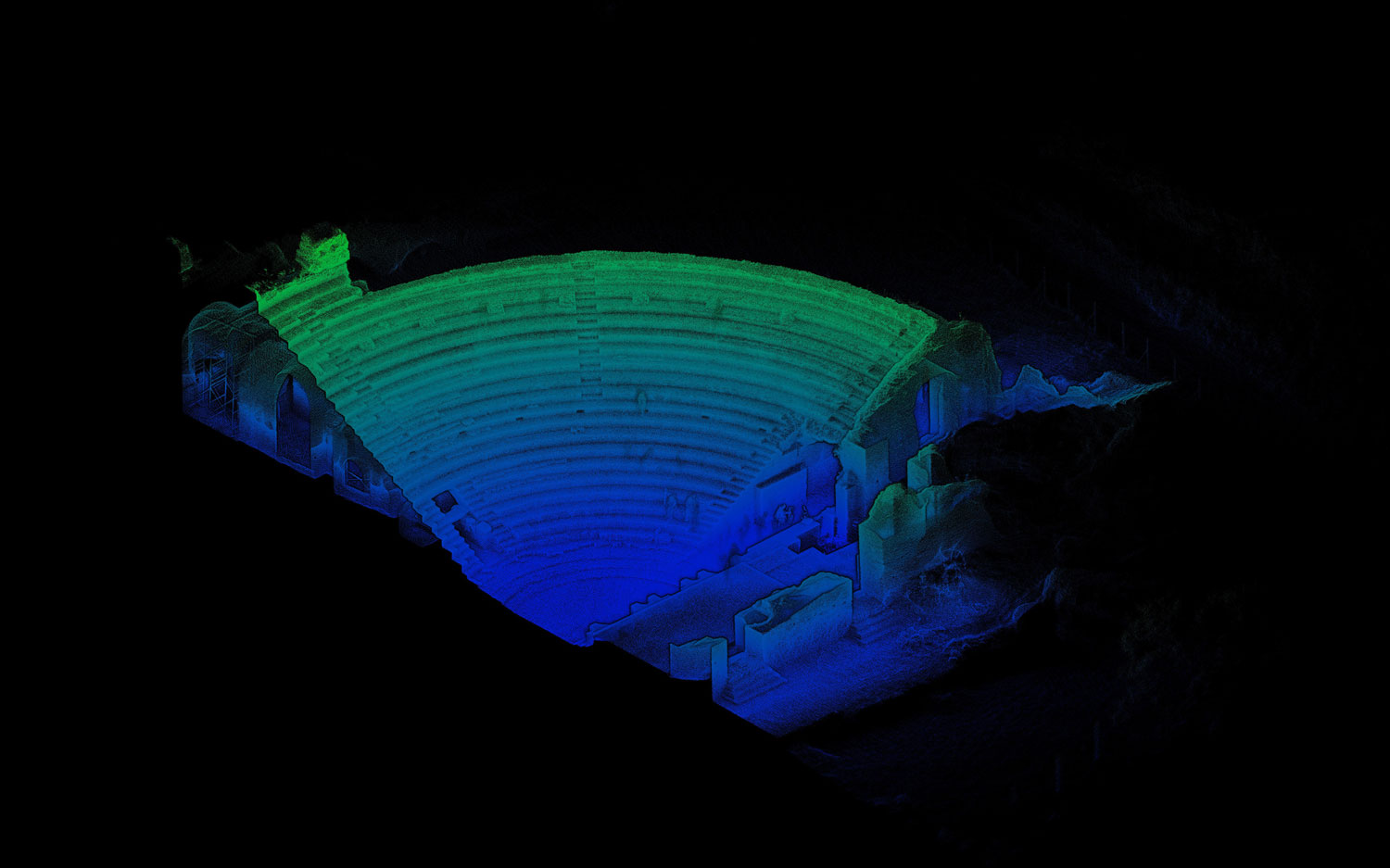
Fortunately, new technology is now available that can change all of this. Handheld 3D laser scanners can see a site mapped out ten times faster than traditional survey methods and with an average data deviation of just 0.1 per cent. In turn, there is a reduced chance of key features being missed since these scanners are lightweight enough to hold whilst simply walking through the survey environment.
Scanners such as these are ideal for the rapid mobile mapping of enclosed, external and multi-level environments like tombs and caves. The speed and simplicity of mobile mapping can facilitate further study, as well as enabling the production of accurate 3D models of the site to be produced.
The ZEB-REVO, our latest mobile mapping device, features an automated rotating scanner head that can be pole mounted, handheld or attached to a chosen mobile platform such as a vehicle or drone. The system captures over 43,000 measurement points per second, meaning many sites can be surveyed in a matter of minutes as opposed to hours, saving both time and money.
There are sites to be discovered – and rediscovered – with this new technology all over the world. Since the device has no requirement for GPS and an indoor range of up to 30m, it is ideal to use at sites that are unexplored, remote or underground.
In a more uncertain world, it becomes ever more crucial to record the relics of the past so that they are not lost to acts of war, terrorism, or simply the passage of time. By producing a digital 3D model, these relics can be studied for decades – if not forever – depending on the advancement of digital data filing.
Globally, there is a rising demand for the 3D documentation of historic sites, for cost and time reduction purposes, delivering high quality data that can be used for a variety of purposes. The Middle East has seen a welcome increase in archaeological study with, for instance, the Qatari government investing heavily in research in Sudan and further discoveries being made at Petra in Jordan and in Northern Iraq.
This kind of handheld technology, which makes the recording of such monuments so much easier, will help to preserve the history and culture of the Middle East and beyond for generations to come.
GeoSLAM currently has distributors across the world. For further information, visit www.geoslam.com or email info@geoslam.com
All image credits: www.landmark.com.gr