
HMS Hampshire sank on the 5th June 1916 when she struck a mine laid by German U-Boat U75. The wreck is located in approximately 60 metres of water off the west coast of Orkney and sank while en-route to Archangel in Russia. She was transporting Lord Kitchener, Secretary of State for War, to a meeting with Tsar Nicholas II. Of the 667 people who had left Orkney only 12 survived the sinking. Kitchener was not among them. He died along with his staff.
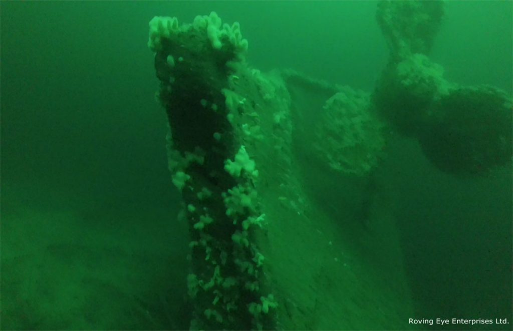
The Roving Eye Enterprises ROV survey confirmed previous findings that HMS Hampshire capsized as she sank and lies with an upturned hull on the seabed in approximately 60m of water. The superstructure itself is compressed and is buried in the soft silt of the seabed. The hull is damaged in places throughout the length of the vessel, exposing various elements of the interior, including torpedo tubes and machinery. Guns from the ship’s secondary armament were also identified on the surrounding seabed at a distance of up to 30m from the main body of the wreck. The location of these breech loading 6-inch MK VII guns may be related to the sinking event or salvage activity on the wreck.
Sandra Henry, University of the Highlands and Islands Archaeology Institute said that “This remote survey has provided many new insights into the sinking and wreck of the HMS Hampshire. Ongoing work will continue to develop our knowledge base, revealing new information as we continue to gather and process data, creating a record of the Hampshire in 2016”
Keith Bichan of Roving Eye Enterprises Ltd commented that, “It was a real privilege to be involved with this project. I am an Orcadian who has had had an ROV business in Orkney for nearly 20 years and the HMS Hampshire was a wreck I always wanted to visit, due to its importance to First World War history, and the mystery and controversy that still surrounds it.”
Further survey work using the Seatronics Predator ROV is in the planning stage.