
Archaeological finds reported through marine industry protocols are now available online here.
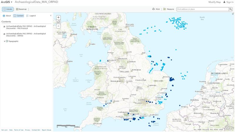
The Crown Estate has made data generated from the Marine Aggregates Industry and Offshore Renewables Protocol available online in WGS84 Lat/Long format, and is committed to periodically updating these datasets for the next three years.
Only those records that the developers have agreed to release into the public domain are included in these datasets.
There are three ways to use the datasets:
1. You can simply view them through a browser here. There’s no need to have a Geographic Information System (GIS) programme to view the data this way. All of the finds from the industry protocols are geographically positioned on the map. For those who are interested in a particular find type, it is possible to filter the data by find type, for example, cannonballs, mammoth teeth, aircraft fragment or whatever else is of interest.
2. You can open them using ArcGIS software by selecting ‘Open in ArcGIS for Desktop’ located in the right-hand menu, which also includes the metadata for the layers. Once ArcGIS has opened the shapefiles can be exported.
3. Or, you can add the ArcGIS server to your mxd so the datasets will always be up to date.
In ArcCatalog:
• click ‘GIS Servers’ in the Catalog Tree
• Double-click ‘Add ArcGIS Server’
• Click ‘Next’
• Add the URL http://services2.arcgis.com/PZklK9Q45mfMFuZs/arcgis/rest/services/ArchaeologicalData_MAI_ORPAD/FeatureServer
• Click ‘Finish’.
The layers appear in the GIS Servers section of ArcCatalog and can be added to the mxd. Other useful layers will also be visible including offshore aggregate and windfarm areas, territorial waters and continental shelf, but be aware they’re in British National Grid (BNG).
These datasets will be useful for developers and planners, researchers and archaeologists when investigating areas of seabed for archaeological studies or development. Or they could be of interest to the curious beachwalker or diver who wants to know what’s been discovered off their local coastline.
Source: Wessex Archaeology